
Ordnance Survey six inch to the mile map of Buckley: Fig.3 of 'When did Buckley become a Town?' by Neville Dunn"
Buckley
1870
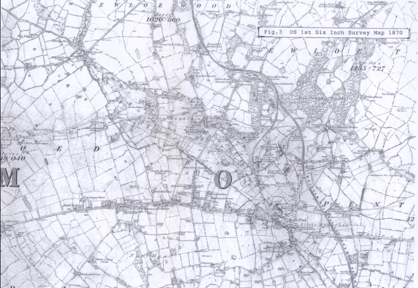
Fig. 3. Copy of the Ordnance Survey's first national survey map at a scale of 6 inches to 1 mile dated 1870 but updated to include railways as they existed in 1888
see 96.23 for the article Fig 1. and 96.24 and 26 for Fig.2 and Fig.4
(please note that larger scale maps of the area are included in the archive where more detail may be seen)
Author: Dunn, Neville
Tags
Year = 1870
Document = Map
Landscape = Urban
Extra = Pre 1900
Copyright © 2015 The Buckley Society