
Ordnance Survey map of The Square area of Buckley"
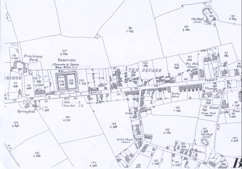
Mold Road, Buckley
1912
Flintshire Sheet XIV 5
Edition of 1912
Surveyed in 1869 - 70
Revised in 1909
Altitudes are given in Feet above the assumed Mean Level of the Sea at Liverpool which is 0.650 of a foot below the general mean level of the Sea.
Altitudes indicated thus (B.M.+ 54.7) refer to Bench marks on Buildings, Walls, etc., those marked thus (+52) to surface levels.
Crown copyright reserved.
( see 23.5 for another O.S. map covering a similar area)
*************************
The hot spot "Griffiths, Benjamin, 1862 - 1935" indicates the property refered to in entry number 106.1 which gives the plan for the property and details of the indenture between Benjamin Griffiths and Robert Jones.
Author: Ordnance Survey
Tags
Year = 1912
Document = Map
Landscape = Urban
Extra = 1910s
Copyright © 2015 The Buckley Society