
Ordnance Survey Map of the Bannel area"
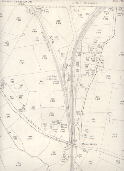
Bannel, Buckley
1912
Flintshire Sheet XIV 10
Edition of 1912
Surveyed in 1869
Revised in 1909
Scale 1 - 2500 being 25.344 inches to a Statute Mile
or 208.33 Feet to One Inch
Altitudes are given in Feet above the assumed Mean Level of the Sea at Liverpool which is 0.650 of a foot below the general mean level of the Sea.
Altitudes indicated thus (B.M.+ 54.7) refer to Bench marks on Buildings, Walls, etc., those marked thus (+52) to surface levels.
All rights of reproduction reserved.
Author: Ordnance Survey
Tags
Year = 1912
Document = Map
Landscape = Urban
Transport = Rail
Extra = 1910s
Copyright © 2015 The Buckley Society