
Archaeological Dig at Taylor's Pottery Site"
Taylor's Pottery, Alltami, Buckley
13 July 2005
Follow the hotspots for "Taylor's Pottery site" for other pictures of the dig.
See also 1.618 for a drawing of a blunging pit and an account by James Bentley; and 129.2 and 3.180
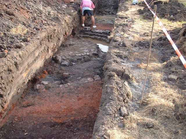
On 13th and 14th July 2005, an archaeological dig was carried out by Earthworks' experts Leigh Dodd and Les Boganar on the plot of land next to "Agincourt". The owner of the land, Graham Foxley, had applied for and was granted permission to build on the land after the dig had been carried because the site was part of the land on which Taylor's Pottery once stood. The main part of the pottery was situated in the field across the lane, now protected by CADW. Some parts of buildings and shafts still remain in the field.
Two trenches were dug, one parallel to Alltami Road and the other, featured in this photo, at right angles to it. The first trench, dug and filled in in a day, revealed nothing but a shallow clay excavation - a storage area.
This second trench, however, revealed a blunger - half of which was seen in the pit. Mr Dodd said this was what they expected to find. He said that the pottery is on the First Edition Ordnance Survey map (late 1800's) but it had gone by the Second Edition (early 1900's).
Author: Anon
Tags
Year = 2005
Month = July
Day = 13
Event = Historic
Landscape = Industrial
Work = Light Industry
Extra = 2000s
Copyright © 2015 The Buckley Society