
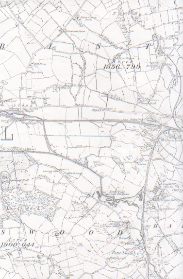
Ordnance Survey Map of the Padeswood Area"
1912
Around 1880, the Padeswood area employed about 3,000 people, according to information provided by Mark Morris who was employed at the Jump Colliery. The colliery closed in 1880. He told me that they did not employ pit ponies underground, but used donkeys. He remembered seeing them graze in the fields at Bistre Farm.
It was a hive of industry with there being three collieries, four oil works, a chemical works, and the Provident Iron Works, not to mention all the farms.
This map shows that the landscape is mainly farmland. I was told that the land where Padeswood Pond is collapsed and sank six feet overnight, resulting in the present Padeswood Pond being formed. The collapse was due to mineworkings below the surface.
James Griffiths (Webbert) once told me that he worked under where the Padeswood pond is when he was employed at the Mountain Colliery. From what I learned when drilling occurred some years later by an opencast company, there are at least three coal seams runnning underground in that area, one 3'9", one 10'6" and one 10". The 10" seam was a hundred metres deep and was of such high quality that it was worth excavating even at that depth. Local opposition however was later to prevent any open cast mining going ahead.
It is said that the oil being transported by rail when the Abergele Rail Disaster occurred was probably produced at Padeswood.
Author: Fisher, Bill, 1922
Tags
Year = 1912
Document = Map
Landscape = Urban
Transport = Rail
Extra = 1910s
Copyright © 2015 The Buckley Society