
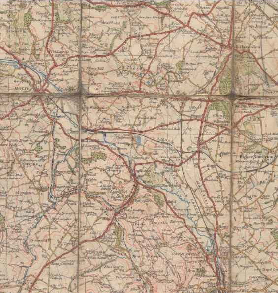
One Inch Ordnance Survey map of Chester Area "
Buckley
1927
One inch to the mile map of the Chester Area.
Surveyed 1869-75. Published 1887
Rev. 1904-5; 1919-20. Published 1924
Minor Corrections 1927. Published 1927
*******************************
The major landamarks have been added to the hot spots.
There are discrepancies of spelling between this map and other maps and documents.
Examples: this map quoted first
Pen brigog; Pen-Brig-Gog; Pen-brigog
Pen-y-Ffordd; Penyffordd
Pen-y-Mynydd; Penymynydd
Garreg-lwyd; Garreglwyd
Cold Arbour House; Cold Harbour House
Author: Ordnance Survey
Tags
Year = 1927
Document = Map
Landscape = Cultivated
Extra = 1920s
Copyright © 2015 The Buckley Society