
An Industrial and Pottery Walk round Buckley - Number 33"
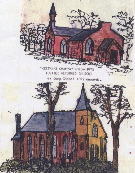
Saint John's United Reformed Church, Buckley
1967
see entry 1.239
AN INDUSTRIAL AND POTTERY WALK ROUND BUCKLEY - NUMBER 33
Opposite "Keetra's Chappa" is an open stretch of land known as "The Mountain". A shallow pond is situated in the centre. It is the remaining traces of a lake which existed and is recorded in 18th century estate maps. It was known as Buckley Lake.
The water outlet passed along Hawkesbury Road, Elfed School, Alltami and Ewloe Castle and entered the estuary at Wepre. A boundary stone still existant near Hawkesbury marks an ancient road to Mold crossed the boggy outlet to the lake. It is recorded in a leete document as "the horse causeway". And the road from Ewloe Green to Buckley Mountain is recorded as "Marl Pit Lane".
Author: Bentley, James
Tags
Year = 1967
Building = Religious
Extra = Visual Arts
Copyright © 2015 The Buckley Society