
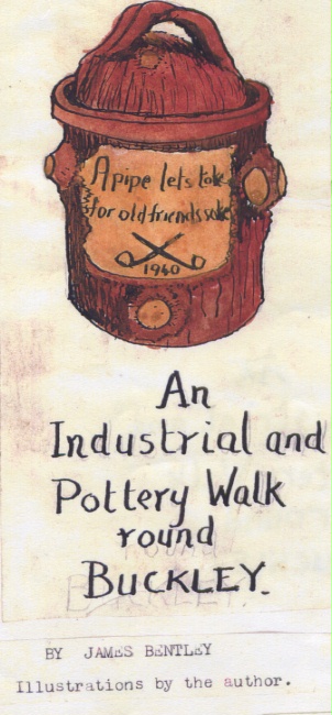
An Industrial and Pottery Walk round Buckley (includes example of pottery)"
1967
{ Please note that the text was written some time ago and certain details will be out of date}
AN INDUSTRIAL AND POTTERY WALK ROUND BUCKLEY
Illustrations by the author
A copy of the original is at Buckley Library. Our archive includes all the illustrations and accompanying text, including a map at entry number 1.240
------------------------------------------------------------------------------------------------------
INTRODUCTION
Buckley gained its full status as an urban district and town in 1897. Previously, it was a heavily populated and industrial collection of dwellings distributed between the small villages of Hawarden and Mold. The north part of Buckley was roughly situated in Hawarden Parish, with its daughter church, Saint Matthew's, and the south side was roughly in Mold Parish, served by Bistre Emmanuel Church.
The nothern part of Buckley covered the townships of Ewloe Town and Ewloe Wood as well as Argoed and Pentrobin. The south part was in the township of Bistre. When Buckley became an urban district, a chairman, surveyor, sanitary inspector and rate collector were employed and councillors elected to represent wards previously occupied as townships. Buckley now comprises one of the towns in the county of Flintshire.
In Norman times, Buckley was situated in wasteland, that is, uncultivated scrub and bog in which animals would roam wild. Sometimes it was occupied by the Welsh princes; othertimes by Saxon earls and then the Norman Earl of Chester and his men.
Just before the Conquest, Gruffydd, Prince of Gwynedd, owned a palace at the Wylfa, Mynydd Isa. Later, Edwin, Earl of Mercia, invaded, and in turn was ousted by Hugh Lupus, Earl of Chester.
Edwin was allowed to retire to a palace near Northop, still called Llys Edwin. Because this area was used as a hunting park for the ruling monarchies, it is said that Buckley was named as a compound for retaining "bucks" - hence Buckley. Other alternative reasons for the name of the town have been suggested. One is that the Old English name for clay pitcher is a "boc"; and the ancient name for a track was a "ley". Perhaps even in the distant past, earthenware vessels were made here alongside the ancient track into Wales.
In 1322, reference is made of the forest and mill of Ewloe, together with the pasturage of Bokelegh and the coal mines and the pleas and requisites to the court. At this period, the area comprising north Buckley and extending down to the estuary at Wepre had been given to Llewelyn, Prince of Wales. He built Ewloe Castle, which is just within the parish boundary of Saint Matthew's Parish Church. It was a Welsh settlement.
From this period until the Industrial Revolution and the establishemnt of identifiable places of industry on Buckley Mountain, our locality was identified as Ewloe.
The origin of this name is, again, perplexing. It has been suggested as a place of pasturage for female sheep. Perhaps it had arisen from the mispronounciation of a name for the Welshmen who settled in this area, surrounded by Anglo-Norman settlements.
This name "Walliae" or in Old English "Waelesch" meant a foreigner, or stranger. Hence "ooliae" became Ewloe or Yowley.
Even until the end of the civil wars, most of the county was torn by strife and guerilla-type warfare and as a result many records of our heritage are lost.
24th November 1985.
Author: Bentley, James
Tags
Year = 1967
Landscape = Urban
Copyright © 2015 The Buckley Society