
Ordnance Survey map of the Old Ewloe Brickworks and area"
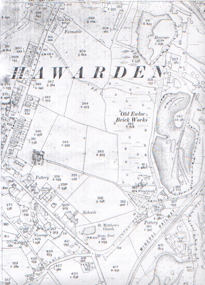
Old Ewloe Brickworks, Buckley
1912
Flintshire Sheet XIV 6
Edition of 1912
Surveyed in 1869 - 70
Revised in 1909
Altitudes are given in Feet above the assumed Mean Level of the Sea at Liverpool which is 0.650 of a foot below the general mean level of the Sea.
Altitudes indicated thus (B.M.+ 54.7) refer to Bench marks on Buildings, Walls, etc., those marked thus (+52) to surface levels.
Crown copyright reserved.
[ Saint Matthew's Parish Church is one of the highest points above sea level in Buckley. This map gives "B.M. 526.1"]
Author: Ordnance Survey
Tags
Year = 1912
Document = Map
Landscape = Industrial
Transport = Rail
Work = Heavy Industry
Extra = 1910s
Copyright © 2015 The Buckley Society